Bridge the Gap between Citizens and Government
Smart governments use GIS for making evidence-based decisions. ArcGIS manages a variety of data types and creates easily understood map interfaces, enabling policy makers and political candidates to conduct complex analyses and glean the necessary insight to formulate sound policy. Whether it's for citizens tracking the activities of their representative, lawmakers needing to understand the reaction to proposed policy changes, or the office wanting to promote its good works in the state or district, ArcGIS provides a way for citizens and their representative to connect through a common visual language.
Through an enterprise agreement with Esri, congressional staff have unlimited access to Esri technology. Everyone in the office is able to make and share maps online with ArcGIS. From calculating appropriations to understanding a myriad of policy concerns, legislators are using ArcGIS to inform their decision-making and measure the progress of their policies.
ArcGIS enables Congress to better serve the public.
Capitol Spotlight: GIS and Policy
The Congressional Research Service’s GIS Team provides Congress and its staff with many GIS services, including interactive web maps, which enable policy makers to identify how features intersect with proposed legislation.
GIS for Policy Webinar Series
Join our webinar series to learn how members of Congress and their staff are using location data to map constituent correspondence, analyze policy issues, and create compelling story maps.

GIS technology and open data quite literally provide a map to making policy smarter and more transparent. Communities benefit when policy makers have easy access to authoritative data and use it to understand trends, plan for natural disasters, and better inform the public.

Investigate Policy Issues
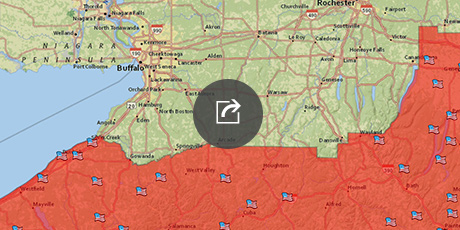
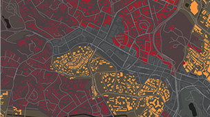
Identify resources, assets, or incidents across the nation and understand how they intersect with proposed policy, then map appropriations by geography and issue.

Understand Constitutients
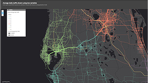
Analyze policy issues that are important to each state or district, map member visits and rates of correspondence, and plan future engagements.

Communicate Using Maps
Embed maps or galleries on websites or in press releases, or share them through social media.
5 Steps to Creating an Esri Story Map Tour
Provide a visual platform to share how your representative is working for your constituents when back in the district.
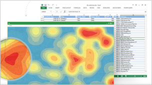
5 Steps to Mapping Constituent Correspondence
Visualize incoming or outgoing correspondence to improve outreach efforts and better understand constituent sentiment.
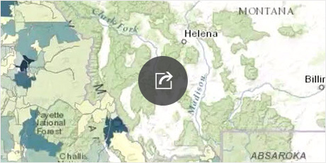
5 Steps to Mapping Public Lands
Learn how you can map public lands by state or district by using the authoritative web mapping layers available in SAMS and HouseMAP.