Approaching regulation is requiring gas utilities to know in greater detail what is buried underground and its origin. For plastic pipe, your GIS is the ideal system of record to store the more detailed data resulting from scanning the 16-character barcode placed on plastic pipe to help gas utilities collect this knowledge.
Transforming Data Management
 Build a Modern Utility Network

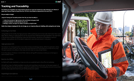
Gas utilities are using new technologies to transform how they collect required Tracking and Traceability data. With Esri and Esri Partners, you now have the power to:
- Collect the barcode and high-precision GPS coordinates during pipe install
- Integrate installation records directly into your GIS
- Manage, monitor, and report for safety & compliance
All this is done seamlessly where updates are made instantaneously and everyone has access to the data they need whenever, wherever, and on any device.